Dovre - Kongsvoll
Arrival Dovre
The starting point in Dovre is easiest reached by first traveling to Dombås, which is a train stop on both the Dovre Line (Oslo–Trondheim) and the Rauma Line from Åndalsnes. At Dovre station, only one train from Oslo stops daily.
- Visit www.entur.no for route planning and tickets for both bus and trains
- From Dombås station, you can take a local bus or a taxi to Dovre station (13 km)
From the end point of the hike at Kongsvold, you can take the train toward Oslo or Trondheim. The pilgrim trail passes close to the station.
There is a supermarket in Dombås and in Dovre. There are no supermarkets in the mountains, but most accommodations serve food.
Recommended hiking period
Do not set off too early in the year, and remember to bring appropriate equipment.
Until about 15th of June, Pilegrimsleden across Dovrefjell is considered technically closed, meaning that the infrastructure is limited and some hostels may be closed. The rivers are full of icy meltwater and cannot be crossed safely. Bridges over the rivers Hondyrju and Vesle Hondyrju are installed around 15th of June.
We also want to bring attention to the fact that the first part of this route goes through calving areas for wild reindeer. The reindeer are highly vulnerable and are a species of European conservation responsibility. Show caution and consideration. We strongly encourage people not to walk Pilegrimsleden across Dovrefjell before the calving period is over. In the action plans for conserving wild reindeer, the Ministry of the Environment recommends 18 June as the earliest date for travel across Hardbakken and Knutshø.
Before setting out, check whether the winter snow has melted and whether the accommodation providers have opened. Pilegrimssenter Dovrefjell can provide guidance on alternative routes. Even after the snow has melted, you must be prepared for rapidly changing weather, and temperatures close to 0°C can occur even in midsummer. Always check the weather forecast at yr.no before crossing, and always carry appropriate clothing in your backpack (including mittens and a hat).
Day 1: (4 km) Dovre - Budsjord
The first day of the trip is used to arrive at the starting point. The milestone outside Dovre Church indicates that it is 250 km from here to Nidaros.
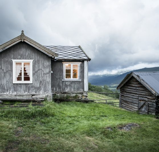
Stay overnight down in Dovrebygda, or begin the ascent toward the mountains and spend the night at Budsjord. On the way up the hills, you will also pass an old church site with a St. Olav’s spring.
Accommodation along this stage

Photo: Eskil Roll
Day 2: (13,2 km) Budsjord - Fokstugu
Today’s stage begins with a steady climb that takes you up into a beautiful high-mountain landscape. The trail follows Kongevegen (the King’s Road). You will eventually reach the open mountain plateau at Ståkån - a name that reflects travel across the mountains in earlier times and the need to mark the route during winter. From Ståkån onward the terrain levels out somewhat, but the ascent continues toward the highest point of Pilegrimsleden between Dovrebygda and Fokstugu. This place is called Hardbakken, and here you'll find a large stone cairn known as Allmannrøysa.
Allmannrøysa is an impressive and important cultural monument, and nearby archaeologists have found a pilgrim badge dating from the 12th century. Even up until today, many people place a stone here as a symbol of something heavy they have been carrying. On the final part of the stage, you will cross the rivers Hondyrju and Vesl-Hondyrju before continuing down to Fokstugu Mountain Lodge or further on toward Furuhaugli.
Accommodation at Fokstugu:

Day 3: (24,2 km) Fokstugu - Hjerkinn
This stage is perhaps the most beautiful stretch of this trip. Along the trail you will see both burial cairns and trapping pits as you move through mountain landscapes that are rich in fascinating wildlife and abundant plant life. The stage starts with an assent, and afterwards the trail passes multiple mountain lodges and tourist cabins that are well suited for rest stops.
After Hageseter, you will pass the restored remains of two medieval buildings at Vesle-Hjerkinn, the first purpose-built accommodation for travelers crossing Dovrefjell, dating back to the 12th century. At Hjerkinn you will find the beautiful Eysteinkyrkja, built in 1969 for pilgrims and other travelers crossing the mountains. The church is named after King Eystein Magnusson, who ruled Norway from 1103 to 1123 and who, according to the sagas, had shelters built for travelers crossing Dovrefjell.
Pilegrimssenter Dovrefjell is open throughout the summer in Eysteinkyrkja, and everyone is welcome to stop by for a quiet moment, a conversation, a stamp, or to get information about the route further toward Trondheim.
Accommodation at Hjerkinn:

Day 4: (11,8 km) Hjerkinn - Kongsvold
The stretch from Hjerkinn to Kongsvold is majestic. Along the way you have views of both Snøhetta and Rondane, with a beautiful hike along the old King’s Road over Hjerkinnhøe. On the descent from Hjerkinnhøe you pass the cultural heritage site Porten, which marked the old boundary between southern and northern Norway. Today it is the border between two counties and two municipalities. The place is called Porten (“the Gate”) because welcoming archways were erected here when kings traveled across the mountains.
The stage ends at Kongsvold Mountain Lodge, which offers accommodation and is itself a cultural monument. It is the only mountain lodge on Dovrefjell owned by the state, and it has served travelers continuously since the late 17th century. Here you will also find a magnificent mountain garden, created by the botanist Thekla Resvoll in 1923. Just a few hundred meters beyond the lodge you will find Kongsvold Station, where you can take the train toward Oslo or Trondheim.
Acommodation at Kongsvold:
For those who wish to continue the journey beyond Kongsvoll, the ascent up the beautiful and restored Vårstigen awaits further ahead.
The next train station after Kongsvoll is in Oppdal, 47 km further along the trail.

Experiences along this route
-
Church
Dovre Church
Gudbrandsdalsleden -
Cultural Heritage
St Olav's spring and Bergseng Church
Gudbrandsdalsleden -
Cultural Heritage
Tofte Farm
Gudbrandsdalsleden -
Accommodation
Budsjord Farm
Gudbrandsdalsleden -
Accommodation
Fokstugu Mountain Lodge
Gudbrandsdalsleden -
Accommodation
Dovrefjell Lodge (Furuhaugli)
Gudbrandsdalsleden -
Accommodation
Hageseter Tourist Cabin
Gudbrandsdalsleden -
Cultural Heritage
Vesle-Hjerkinn
Gudbrandsdalsleden -
Accommodation
Basecamp Frich's Hjerkinn
Gudbrandsdalsleden -
Church
Eystein Church
Gudbrandsdalsleden -
Pilgrim Center
Pilgrim Center Dovrefjell (summer)
Gudbrandsdalsleden -
Accommodation
Hjerkinn Mountain Lodge
Gudbrandsdalsleden -
Cultural Heritage
Porten (The Gate)
Gudbrandsdalsleden -
Accommodation
Kongsvold Mountain Lodge
Gudbrandsdalsleden
Useful reading
Last stop before the Dovre Mountain
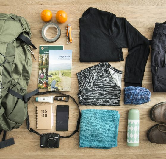
25 items to bring on your pilgrimage if you plan to sleep indoors
Routes nearby
[[ notice ]]
We found no trail suggestions.
Try to filter on something else.